The Index / Unsolved Cases
What Happened to MH370? The Satellite Arcs, the Debris and the Search That Resumes in 2026
Malaysia Airlines Flight 370 vanished on March 8, 2014 with 239 people aboard. What the satellite data, the confirmed debris and the official reports establish, and where the search stands after Ocean Infinity's 2026 attempt.
Topics: MH370, Malaysia Airlines, Aviation mysteries, Disappearances, Indian Ocean, Ocean Infinity
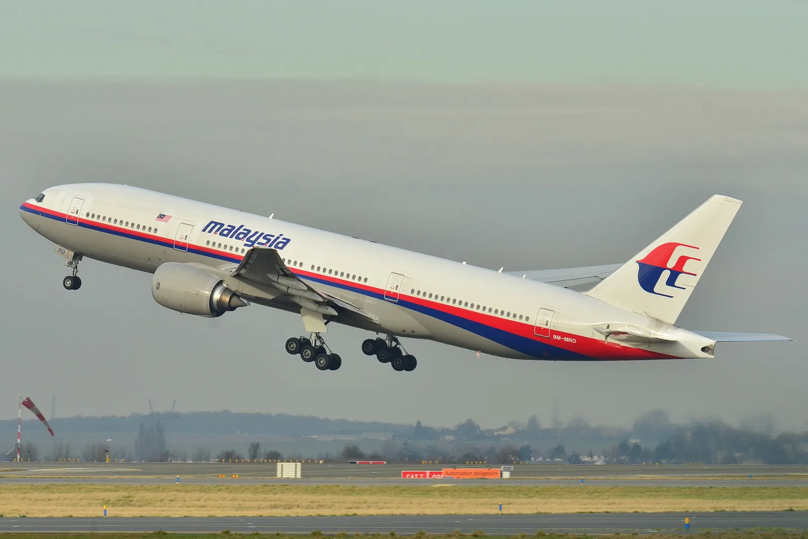
Nobody knows where the aircraft is. Malaysia Airlines Flight 370, a Boeing 777 carrying 227 passengers and 12 crew from Kuala Lumpur to Beijing, lost contact with air traffic control between Malaysian and Vietnamese airspace in the early hours of March 8, 2014. Satellite data later showed it flew for roughly six more hours, ending in the southern Indian Ocean. Confirmed pieces of the aircraft have since washed up on islands and the east African coast. The main wreckage, the flight recorders and the 239 people on board have never been found. Malaysia’s official investigation, published in 2018, said it was unable to determine the cause. The most recent seabed search, by Ocean Infinity, ended in January 2026 without a result, and Malaysia has extended the company’s contract so that it can finish a remaining area of about 7,400 square kilometres between late 2026 and mid-2027.
That paragraph contains three kinds of statement. The timings, the satellite records and the debris identifications are documented. The reconstruction of the flight path is an inference from those records, made by several independent teams who broadly agree. The explanations for why the aircraft turned around are theories, and the official report declined to choose between them. This article keeps those categories separate.
What is documented about the flight?
MH370 departed Kuala Lumpur shortly after midnight local time on March 8, 2014. The Australian Transport Safety Bureau’s final report on the operational search, published on October 3, 2017, lays out the last recorded contacts in Coordinated Universal Time (UTC), which runs eight hours behind Malaysian time.
The aircraft’s last routine ACARS data report was received at 17:07 UTC (01:07 Malaysian time). The last radio transmission from the cockpit came at 17:19:30 UTC, as the flight was being handed from Malaysian to Vietnamese controllers. It passed the waypoint IGARI at 17:20:31 UTC. Its transponder symbol was no longer detected after 17:20:36 UTC, and the last secondary radar position was recorded at 17:21:13 UTC.
After that, the aircraft was no longer visible to civilian air traffic control. Malaysian military primary radar, which does not depend on a transponder, tracked a return that turned back across the Malay Peninsula and out over the Strait of Malacca. The last primary radar position was recorded at 18:22:12 UTC (02:22 Malaysian time), northwest of Penang.
The aircraft’s satellite communications terminal continued to exchange automatic signals with an Inmarsat satellite. The ATSB report lists handshakes at roughly hourly intervals from 18:25 UTC onward, two unanswered ground-to-aircraft telephone calls, and a final aircraft-initiated log-on at 00:19:29 UTC on March 8 (08:19 Malaysian time). An attempted handshake at 01:15:56 UTC received no reply.
| Time (UTC, March 7–8, 2014) | Malaysian time | Event, per the ATSB final report |
|---|---|---|
| 17:07:29 | 01:07 | Last ACARS data report received from the aircraft |
| 17:19:30 | 01:19 | Last radio transmission from the cockpit |
| 17:20:36 | 01:20 | Transponder symbol no longer detected after this time |
| 17:21:13 | 01:21 | Last secondary radar position |
| 18:22:12 | 02:22 | Last primary (military) radar position, northwest of Penang |
| 18:25:27 | 02:25 | Aircraft-initiated satellite log-on; hourly handshakes follow |
| 00:19:29 | 08:19 | Final aircraft-initiated log-on, the basis of the “7th arc” |
| 01:15:56 | 09:15 | Ground-initiated handshake fails; no further contact |
What is the “7th arc”?
The satellite did not record where the aircraft was. It recorded how long each signal took to travel and how its frequency was shifted. The timing of each handshake places the aircraft somewhere on a ring, or arc, at a fixed distance from the satellite at that moment. The frequency data constrains the aircraft’s speed and direction.
Seven such arcs can be drawn, one for each handshake. The seventh corresponds to the final log-on at 00:19:29 UTC. The ATSB report describes it as the arc along which the aircraft probably entered the ocean, “relatively close to the time this last transmission was made.” An unscheduled log-on at that point is consistent with the aircraft’s electrical systems restarting after the engines flamed out for lack of fuel, although the report presents this as the best-supported interpretation rather than a recorded fact.
The arcs are long. They cross the Indian Ocean from the waters off Western Australia to Central Asia. The analysis of the frequency data, together with the fuel the aircraft was carrying, is what pointed to the southern end of the seventh arc rather than a northern route. This is why every seabed search has concentrated on a strip of the southern Indian Ocean west of Australia.
The important thing to hold onto is that the search area is a mathematical reconstruction from indirect data. The search strategy working group that produced it included Inmarsat, Thales, Boeing, the UK Air Accidents Investigation Branch, the US National Transportation Safety Board, Australia’s Defence Science and Technology Group and Malaysia’s Department of Civil Aviation, and its members reached broadly consistent results. That makes the southern Indian Ocean the overwhelmingly best-supported location. It does not make any single point along the arc a confirmed crash site.
What debris has been confirmed?
For more than a year there was no physical trace of the aircraft at all. The ATSB report notes that the surface search, from March 8 to April 28, 2014, recovered more than thirty floating items, all of which were judged unlikely to be connected to MH370.
The first confirmed piece appeared on July 29, 2015, when a large wing component known as a flaperon washed ashore on Réunion, a French island east of Madagascar. NPR reported on September 4, 2015 that French prosecutors had confirmed, by matching serial numbers on the part against maintenance records, that it came from the missing Boeing 777.
Further pieces were recovered in 2015 and 2016 on, in the ATSB’s words, “the shores of Indian Ocean islands and the east African coastline.” The ATSB’s search overview says the bureau examined several items in support of Malaysia’s investigation, including a section of the right outboard wing flap. According to the Malaysian investigation team’s briefing in July 2018, three of the 27 debris items examined by then had been positively confirmed as coming from MH370; others were assessed as likely or almost certain on the basis of their construction, without a unique identifier.
The debris matters in two ways. It establishes that the aircraft broke up in the Indian Ocean rather than landing intact somewhere. And drift modelling of where and when the pieces arrived was used to refine, though not to pinpoint, the most likely area along the seventh arc. The 2018 Malaysian report said there was not enough information to determine whether the aircraft broke up in the air or on hitting the water.
How the searches unfolded
The scale of the response was unusual. The surface search drew on aircraft and ships from many countries; Bernama’s report on the 2026 contract extension summarises the earlier effort as involving 82 aircraft and 84 ships from 26 countries, at a cost of around US$200 million.
Under the international convention that governs air accident investigation, Malaysia, as the state of registry, was responsible for both the search and the investigation. Ministers from Malaysia, China and Australia agreed on May 5, 2014 to take search decisions together, and Australia took the lead on the underwater search through the ATSB.
That underwater search began in October 2014. It was initially planned to cover 60,000 square kilometres of seafloor and was expanded to 120,000 square kilometres in April 2015. On January 17, 2017, after what the ATSB counts as 1,046 days, the three governments jointly suspended it. The ATSB’s final report that October states plainly: “Despite the extraordinary efforts of hundreds of people involved in the search from around the world, the aircraft has not been located.” It also identified an area of less than 25,000 square kilometres along the seventh arc that it judged to have the highest likelihood of containing the aircraft.
Malaysia then contracted the private company Ocean Infinity, on terms under which it would be paid only if it found the wreckage. That search ran from January 16 to May 29, 2018, and brought the total area searched to close to 200,000 square kilometres, stretched over more than 1,800 kilometres of the arc. It found nothing.
What did the Malaysian report conclude?
Malaysia’s Safety Investigation Report, 449 pages long, was released on July 30, 2018. Its investigator-in-charge, Kok Soo Chon, told reporters that the team was unable to determine the real cause of the disappearance. According to Malay Mail’s account of the briefing, the report found no aircraft malfunction or defect that could have contributed, found that the lithium battery cargo had been packed and loaded according to procedure, and found nothing in the pilots’ recorded communications that two psychiatrists on the team regarded as evidence of stress or unusual behaviour.
The report did reach some conclusions. Flight simulator trials indicated that the turn back toward the Malay Peninsula was likely made under manual control rather than by the autopilot. It stated that “the possibility of intervention by a third party cannot be excluded either.” And it criticised air traffic controllers in both Kuala Lumpur and Ho Chi Minh City for failing to initiate the required emergency phases when the aircraft disappeared from their screens, a delay that slowed the start of the search. Nineteen safety recommendations followed, addressed to Malaysia Airlines and the Civil Aviation Authority of Malaysia. The chairman of that authority resigned the next day.
Kok also said that the document should not be regarded as a final report, because conclusive answers would require the wreckage and the flight recorders. The ATSB’s own summary puts it the same way: the reasons for the loss “cannot be established with certainty until the aircraft is found.”
The theories, and what each one has to answer
Because the official investigation did not identify a cause, the public conversation has been dominated by theories. They are not all equal. The useful test for any explanation is whether it accounts for the documented sequence: communications ceasing near the handover point, a turn back under what appears to be manual control, a track across the peninsula visible to military radar, six hours of flight on a southern heading, and debris on the western shores of the Indian Ocean.
Deliberate action by someone in the cockpit. This theory holds that a pilot or another person on board switched off the transponder and flew the aircraft to the southern Indian Ocean on purpose. It fits the manual turn and the long silent flight, which is why it is widely discussed. It is not an official finding. The Malaysian report did not rule out deliberate action by the crew but did not conclude it either, and its investigator-in-charge said he considered a deliberate crash by the pilots highly unlikely. No note, confession or motive has been documented. Naming a person as responsible on the basis of what is currently public would be an accusation, not a conclusion.
Incapacitation and an unresponsive aircraft. A second group of explanations proposes an emergency, such as a fire, decompression or hypoxia, that disabled the crew, after which the aircraft flew on autopilot until the fuel ran out. The ATSB’s search planning analysed and simulated the end of the flight as an aircraft exhausting its fuel, and its final report notes that the aircraft was not configured for a ditching, which is consistent with nobody controlling it at the end. The difficulty is the turn back and the subsequent track, which the Malaysian report assessed as likely manual. No single failure has been identified that explains both.
Hijacking or third-party interference. The official report explicitly left this open. No demand, claim of responsibility or documented evidence of a struggle has ever been made public, and no passenger or crew member has been officially linked to such a plan.
Claims that the aircraft did not go south. Theories involving a landing at a military base, a shoot-down, or a northern route into Central Asia circulate widely. They conflict with the satellite frequency analysis, with the fuel calculations and with the confirmed debris, which drifted ashore in places consistent with a southern Indian Ocean origin. They have not been supported by any physical evidence. The same is true of claims that satellite photographs or amateur radio records have located the wreck: as of this writing, no such claim has been confirmed by any investigating authority.
What the theories share is that each is trying to fill the same gap. The flight data recorder and cockpit voice recorder went down with the aircraft. Until they are recovered, the cause remains unknown in the formal sense, whatever anyone’s private confidence.
Where does the search stand in 2026?
The case moved again in late 2024. On December 20, 2024, Transport Minister Anthony Loke announced that the Cabinet had agreed in principle to a new Ocean Infinity search of about 15,000 square kilometres, on the same no-find, no-fee basis, with a payment of US$70 million if substantive wreckage was located. The company’s vessel Armada 7806 was already on station in the southern Indian Ocean by late February 2025, before the contract had been formally signed; Loke confirmed the deployment on February 26 and said the contract details still had to be finalised. In early April 2025, Loke announced that the operation had been suspended because of poor weather, with the southern hemisphere winter approaching, and would resume at the end of the year. AAP reported the reaction of Kelvin Shim, whose wife was on the flight: the families, he said, had “been waiting for more than 11 years.”
On December 3, 2025, the Associated Press reported that the search would resume from December 30 for a total of 55 days, concentrating on the areas judged most likely to contain the aircraft. China’s foreign ministry said it appreciated Malaysia’s efforts.
The outcome was announced on March 8, 2026, the twelfth anniversary of the disappearance. In a statement, Ocean Infinity said its vessel had left the search area on January 23, 2026. Across its efforts since 2018, the company said it had spent 151 days at sea and mapped more than 140,000 square kilometres of seafloor without finding the aircraft. Its chief executive, Oliver Plunkett, said: “If nothing else, we can say with confidence that it isn’t where we looked.” He added that the company was continuing to work with the Malaysian government “in the hope of being able to return when circumstances allow.”
That return has since been scheduled. On June 29, 2026, Loke announced that the Cabinet had agreed to extend the agreement with Ocean Infinity for twelve months, from July 1, 2026 to June 30, 2027, so that the company can complete a remaining priority area of 7,428.54 square kilometres. The main terms are unchanged: nothing is paid unless wreckage is found. Because Ocean Infinity’s vessels are committed elsewhere, the work can only take place between November 2026 and April 2027, the calmer season in the southern Indian Ocean. Loke described the decision as a sign of the government’s “unwavering and continuous commitment to providing the long-awaited closure for the families.”
The practical significance of the 2026 result is negative evidence. Every square kilometre of seafloor that has been imaged and ruled out narrows the problem. It also tests the reconstruction itself: if the remaining priority area is searched in full and the aircraft is still not there, the question will shift from “where along the arc” to whether some assumption in the analysis was wrong.
What is documented, and what is not
| Question | Status |
|---|---|
| Did the aircraft turn back and fly for hours after losing contact? | Documented: military radar and satellite handshakes, analysed by multiple independent teams |
| Did it end in the southern Indian Ocean? | Strongly supported: satellite analysis, fuel range and confirmed debris on western Indian Ocean shores |
| Has wreckage been identified? | Yes, in part: a flaperon and a flap section among items confirmed by serial numbers or construction; the main wreck has not been found |
| Where exactly did it enter the water? | Unknown; roughly 200,000 sq km has been searched, plus the 2025–2026 Ocean Infinity areas |
| Why did it turn back? | Unknown; the official report could not determine a cause and did not exclude third-party interference |
| Was a specific person responsible? | Not established by any official finding |
| Are the flight recorders recovered? | No |
How this case compares
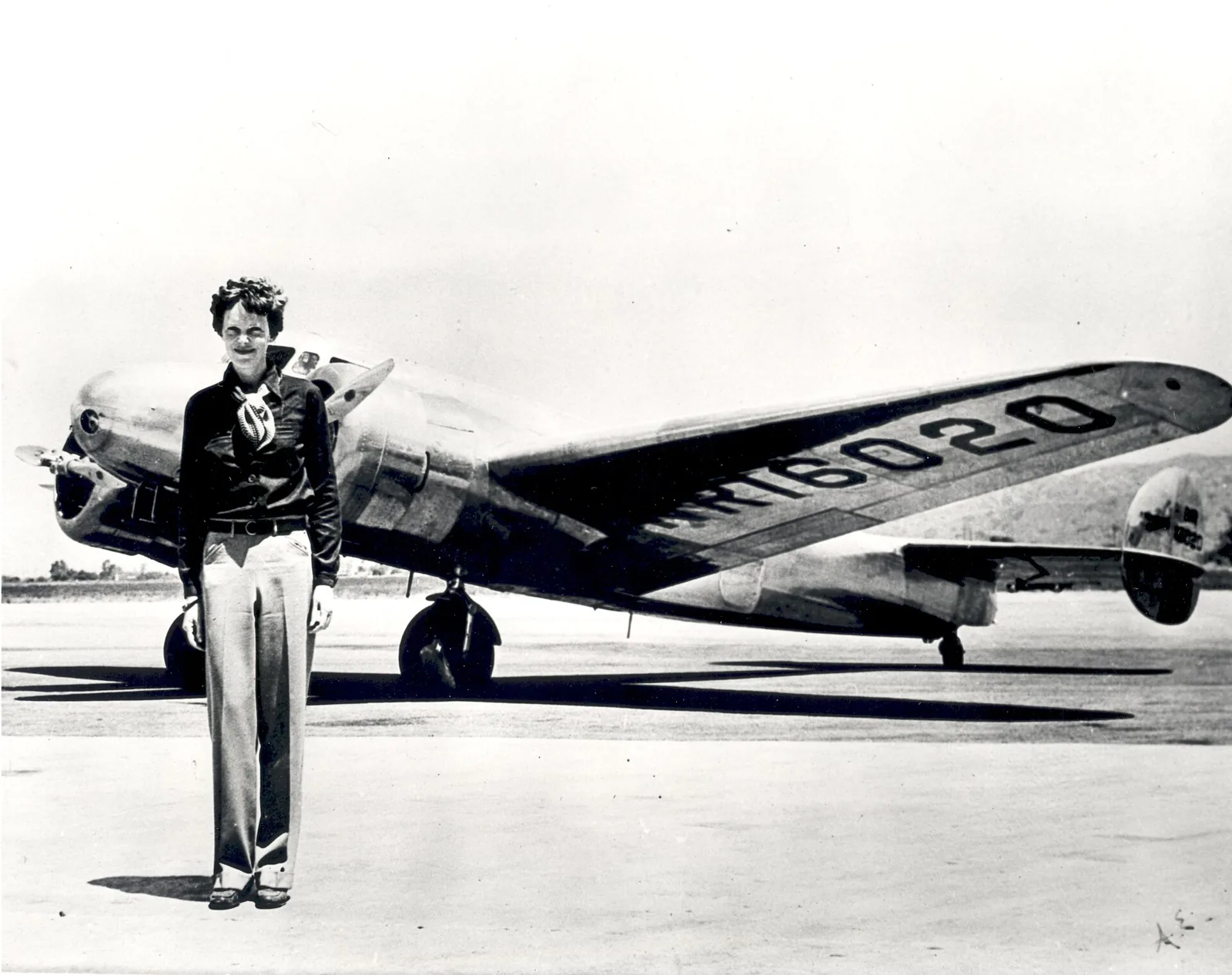
MH370 is the modern counterpart to Amelia Earhart’s disappearance in 1937: a documented last transmission, an enormous search, a small amount of debated physical evidence and a set of theories that outlive each expedition. The difference is the quality of the record. Earhart’s case rests on a radio log and a few bones that were later lost; MH370’s rests on satellite data precise enough to define a search corridor, and on wing parts matched by serial number.
It also belongs with maritime cases that are routinely folded into legend. The Mary Celeste has a thoroughly documented scene and no agreed reason the crew left; the Flannan Isles lighthouse has official reports that are quiet at the decisive moment and a century of invented detail laid over them. MH370 has attracted the same kind of accretion in twelve years, which is one reason for insisting on the distinction between the record and the stories. And because missing aircraft are so often attached to the Bermuda Triangle, it is worth stating that the aircraft’s last recorded position was in the Indian Ocean, on the other side of the planet.
Frequently asked questions
Has MH370 been found?
No. As of October 2026, confirmed debris has been recovered from Indian Ocean shorelines, but the main wreckage and the flight recorders have not been located. Ocean Infinity’s 2025–2026 search ended in January 2026 without finding the aircraft, and a further search window is planned for November 2026 to April 2027.
How do investigators know it flew to the southern Indian Ocean?
The aircraft’s satellite terminal kept exchanging automatic signals with an Inmarsat satellite for about six hours after radar contact was lost. The timing and frequency of those signals, combined with the aircraft’s fuel, point to a long flight ending along an arc in the southern Indian Ocean. Debris found on the western side of that ocean is consistent with the analysis.
What caused the disappearance?
Officially, it is undetermined. Malaysia’s 2018 Safety Investigation Report found no mechanical fault, judged the turn back likely to have been flown manually, and said third-party interference could not be excluded. It did not identify a cause or a responsible person.
Why has the search taken so long?
The probable crash zone is remote, deep and defined only by indirect satellite data. Searching it means imaging the seafloor strip by strip with sonar in some of the roughest seas in the world, which is why work has been confined to the southern summer and has proceeded in phases over more than a decade.
Who pays for the current search?
Under the agreement extended to June 30, 2027, Malaysia pays Ocean Infinity US$70 million only if the wreckage is found. If the search ends without a result, no fee is due.
Sources & further reading
- Australian Transport Safety Bureau: The Operational Search for MH370, final report, October 3, 2017 (last ACARS report, transponder loss, radar, satellite handshakes, the 7th arc, 120,000 sq km search, the 25,000 sq km area)
- Australian Transport Safety Bureau: MH370 search overview (Tripartite decisions, the January 17, 2017 suspension, Malaysia's 2018 search, roughly 200,000 sq km searched in total, debris examined)
- Malay Mail, July 30, 2018: Investigators conclude MH370 disappearance still a mystery (the Malaysian Safety Investigation Report, investigator-in-charge Kok Soo Chon, 449 pages, 19 recommendations, third-party interference not excluded)
- The Star, July 31, 2018: Civil Aviation Authority of Malaysia chairman Azharuddin Abd Rahman resigns a day after the MH370 safety report
- NPR, September 4, 2015: French investigators confirm wing fragment came from Flight MH370 (the Réunion flaperon, serial numbers matched to maintenance records)
- Malay Mail, December 20, 2024: Anthony Loke says Malaysia will resume the search for MH370 (Cabinet agreement in principle, 15,000 sq km, US$70 million no-find, no-fee)
- Marine Insight, February 27, 2025: Ocean Infinity's Armada 7806 begins the new MH370 search before the contract is signed (Loke's February 26 confirmation)
- AAP, April 2025: Search for Flight MH370 suspended due to bad weather (Transport Minister Anthony Loke, the 15,000 sq km area, the US$70 million no-find, no-fee terms)
- Associated Press via ABC7, December 3, 2025: Marine robotics firm will resume deep-sea search for MH370 (search from December 30 for 55 days, Malaysian and Chinese government statements)
- Ocean Infinity, March 8, 2026: Conclusion of the search for Malaysian Airlines flight MH370 (departure from the search area on January 23, 2026, 151 days at sea since 2018, more than 140,000 sq km mapped, Oliver Plunkett's statement)
- The Star / Bernama, June 29, 2026: Govt extends deal with Ocean Infinity to search for MH370 wreckage (July 1, 2026 to June 30, 2027, remaining 7,428.54 sq km, November to April weather window)
- Wikimedia Commons: Boeing 777-200ER Malaysia Airlines 9M-MRO at Paris-Charles de Gaulle, December 26, 2011, by Laurent ERRERA (CC BY-SA 2.0, Flickr review passed November 25, 2013)